TL;DR: A Seal Bay test near China's Qinling Station shows drone photos processed with structure-from-motion can map shallow gravel seabed to 0.43-meter accuracy after correcting for water refraction and filtering ice and rocks.
Why shallow Antarctic bays are hard to map
High-resolution nearshore bathymetric terrain is described in the Journal of Remote Sensing study as baseline data for understanding ice–ocean interaction in Antarctica.
The same study links that terrain data to safe operation and maintenance of Antarctic research stations, not only to science questions about melting and disintegration.
The practical reason is vessel draft. Research icebreakers have a deep draft, so movement of materials and personnel to the station area can rely on small boats, inflatable craft and barge, according to the study.
In that setting, accurate nearshore seafloor topography is presented as essential for safe navigation for those smaller transfer craft.
The authors add two station-area uses: siting marine-science equipment such as underwater observation instruments and support infrastructure such as seawater desalination devices.
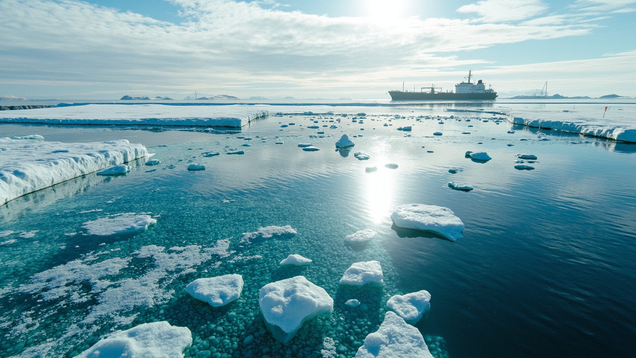
At Qinling Station, the connection is concrete. Transportation between the station and the research icebreaker Xuelong is accomplished by means of small barges, as shown in a 2022 site photo by Lei Zheng reproduced in the paper.
The location diagram for Seal Bay uses Sentinel-2 imagery as its base map, tying the very-high-resolution drone work to a familiar satellite view.
What existing tools could not do cheaply
Under harsh Antarctic conditions, the paper says nearshore bathymetry measurement has mainly relied on shipborne single-beam and multibeam sonar, including uncrewed surface vehicle sonar.
That approach is described as inefficient and as carrying a risk of grounding in shallow waters.
Spaceborne laser altimetry and airborne laser bathymetry offer another path because a green-wavelength channel can penetrate clear water to measure seabed elevation. The study cites ICESat-2 as the spaceborne example and airborne laser bathymetry, often abbreviated ALB, as the airborne example.
But neither is presented as a complete low-cost answer. According to the Journal of Remote Sensing paper, the ICESat-2 mission has large gaps in bathymetric data between measurement tracks, while ALB is limited by high equipment costs.
Spectrally derived bathymetric mapping can provide spatially continuous underwater topography, the authors note, but it is susceptible to substrate differences.
The result, in their assessment, is a lack of cost-effective means for high-resolution seabed terrain detection in shallow-water bays.
Traditional surveying methods for shallow-water topography are separately described as inefficient and costly, while satellite remote sensing techniques are described as limited by spatial resolution.
The drone alternative tested at Seal Bay
The proposed alternative is uncrewed aerial vehicle-based structure-from-motion photogrammetry, or UAV-SfM photogrammetry.
Structure-from-motion is defined in the paper as a technique for reconstructing three-dimensional structures from two-dimensional images, capable of generating high-resolution topography using consumer-grade cameras.
Combined with UAVs, the authors say, the technique has been widely applied to model surface features, including features in Antarctica.
Flight control matters. By controlling flight altitude and camera viewing angle, and using multi-view stereo algorithms after structure-from-motion, operators can obtain high-density point clouds, according to the study.
The method is noted to have detection capability for shallow-water topography with rich substrate textures, which suits gravel beds where the bottom provides visual texture.
A further advantage cited is integration: the technology can measure both terrestrial and shallow-water topography and place them in the same coordinate reference system.
The authors characterize UAV-SfM as a high-efficiency and low-cost technique that provides new opportunities for coastal geomorphic research.
For the Antarctic test they selected Seal Bay near China's Qinling Station as the example of a gravel-bed bay, with a workflow and applicability assessment aimed at that coastal type.
Three problems specific to gravel-bed bays
The paper isolates three obstacles to bathymetric terrain extraction from UAV-SfM in Antarctic gravel-bed bays: refraction effects, floating ices and large gravels.
Refraction bends light at the air-water interface, so depths estimated directly from photos appear shallower than reality unless corrected.
Floating ice creates false surfaces above the seabed in the image-derived cloud.
Large gravels complicate separation of true ground from detached objects sitting on or above it.
The workflow is therefore built around two corrections after the first reconstruction: refraction correction and ground filtering.
In sequence, UAV-captured overlapping images are used to reconstruct an initial dense point cloud, then accurate bathymetric digital terrain models are obtained by combining those correction and filtering methods, as reported in the Journal of Remote Sensing.
How accurate the corrected depths were
Validation used in situ uncrewed surface vehicle measurements as the reference for the drone-derived depths.
Under nadir viewing-angle conditions, the small-angle refraction-correction method achieved a coefficient of determination, R², of 0.83, according to the study abstract.
The same comparison gave a root-mean-square error of 0.43 m.
Nadir here means the camera looks straight down, which keeps viewing rays close to vertical and simplifies the refraction geometry handled by the small-angle approach.
The authors do not present the result as perfect bottom mapping in all conditions. The numbers are tied to that nadir configuration and to comparison against surface-vehicle sonar in the test bay.
For U.S. readers following polar logistics, the scale matters: sub-half-meter vertical error is useful for recognizing shoals, channels and berthing hazards for barges and small boats, even though it does not replace close-in sonar for final navigation decisions.
How ice and gravel were removed
The second reported metric concerns classification: separating underwater terrain from floating ice and gravel pieces.
The paper applies cloth simulation filtering to remove floating ices and gravels from the underwater-terrain extraction.
Classification accuracy for that step exceeds 97%, as stated in the abstract.
In practical terms, the filter is intended to drape a virtual surface over the inverted point cloud to identify ground points, leaving elevated ice chunks and large clasts as non-ground.
That step is important in Seal Bay because both seasonal ice fragments and coarse beach material can appear in the same shallow scene.
The headline claim is therefore two-part: refraction correction addresses vertical bias from water, while ground filtering addresses contamination from objects that are not seabed.
Why the authors say it can travel
The study concludes that the approach provides a cost-effective strategy for bathymetric terrain extraction.
It is described as easily applied in other shallow gravel-bed bays along Antarctic coastlines.
That transferability argument rests on using overlapping consumer-camera imagery, standard dense-cloud reconstruction, and the two documented corrections, rather than expensive airborne lidar for every site.
For stations that need repeated nearshore surveys after storms, ice push or construction, a repeatable drone workflow has operational appeal.
The link to station maintenance is explicit in the introduction: nearshore bathymetry supports both basic data on coastal surface processes and decisions about station-area construction and resupply routes.
Independent context: when SfM rivals lidar
A separate September 2026 coastal comparison provides useful context on how far image-based elevation has come, as reported by Photogrammetric Engineering & Remote Sensing.
That study, led by Jakub Sledziowski of the University of Szczecin, compared UAV lidar with RGB-based structure-from-motion over eight repeat surveys in 2022 and 2023.
The flights used a DJI Matrice 300 real-time kinematic drone carrying a Zenmuse L1 sensor over a 1-km dune-beach system at Mrzezyno on the southern Baltic coast of Poland.
Both pipelines produced digital elevation models from the same flights, for a total of 16 DEMs, using an automated workflow with 895 cross-shore profiles.
The extracted measures included shoreline position, beach and dune widths, elevations, slopes and volumetric change, related to tide-gauge hydrometeorology with deep neural networks and driver-consistency checks.
Both lidar and SfM captured consistent temporal trends and pointed to the same dominant drivers, with storm activity by event count and duration together with wave and sea-level conditions explaining most variability, according to that journal summary.
Differences were largest over water surfaces and locally in vegetation-affected dune areas, where lidar produced fewer artifacts.
Despite those local deviations, net beach-plus-dune volume change between the first and last survey differed by only 0.48% between lidar and SfM.
The authors' inference, as summarized by the publisher, is that SfM can provide comparable coastal-change information for many monitoring tasks when survey geometry and quality control are carefully managed.
That Baltic result does not validate Antarctic bathymetry directly, but it supports the broader claim that well-controlled photogrammetry can approach lidar for change detection outside vegetated or open-water zones.
What to watch next
The Seal Bay paper is framed as a workflow and applicability assessment, not as a continent-wide chart.
Open questions for operators include performance in deeper or more turbid water, under off-nadir viewing, and when substrate texture is weak.
Repeated surveys through a melt season would also test how floating ice cover and light conditions change accuracy.
For now, the verified result is narrow and useful: overlapping drone imagery, corrected for small-angle refraction and cleaned with cloth simulation filtering, reproduced shallow gravel-bed terrain near Qinling Station with R² of 0.83 and 0.43-m error against surface-vehicle data, with over 97% classification accuracy for the filtering step, according to the Journal of Remote Sensing.
Sources referenced
- UAV-Based SfM Photogrammetry for Bathymetric Terrain Extraction in Antarctic Shallow Bays Near China's Qinling Station | Journal of Remote Sensing (https://spj.science.org/doi/10.34133/remotesensing.1071)
- UAV Lidar vs. Structure-from-Motion (SfM) Photogrammetry for Coastal Dune Monitoring: A Two-Year Multi-Temporal Case Study from the Southern Baltic Sea (https://www.ingentaconnect.com/content/10.14358/PERS.26-00015R2)